


Frohna Voting District, Perry County, Missouri
About
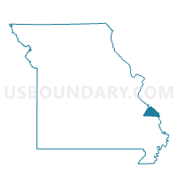
Outline

Summary
| Unique Area Identifier | 609331 |
| Name | Frohna Voting District |
| County | Perry County |
| State | Missouri |
| Area (square miles) | 23.36 |
| Land Area (square miles) | 22.76 |
| Water Area (square miles) | 0.61 |
| % of Land Area | 97.40 |
| % of Water Area | 2.60 |
| Latitude of the Internal Point | 37.65861150 |
| Longtitude of the Internal Point | -89.61738350 |
Maps


Graphs
Select a template below for downloading or customizing gragh for Frohna Voting District, Perry County, Missouri


Neighbors
Neighoring Voting District (by Name) Neighboring Voting District on the Map
- Altenburg Voting District, Perry County, MO
- DEGOGNIA Voting District, Jackson County, IL
- Farrar Voting District, Perry County, MO
- FOUNTAIN BLUFF Voting District, Jackson County, IL
- Longtown Voting District, Perry County, MO
- New Wells Voting District, Cape Girardeau County, MO
- Uniontown Voting District, Perry County, MO
Top 10 Neighboring County Subdivision (by Population) Neighboring County Subdivision on the Map
- Shawnee township, Cape Girardeau County, MO (3,910)
- Brazeau township, Perry County, MO (1,100)
- Union township, Perry County, MO (1,062)
- Salem township, Perry County, MO (673)
- Fountain Bluff township, Jackson County, IL (208)
- Degognia township, Jackson County, IL (153)
Top 10 Neighboring Place (by Population) Neighboring Place on the Map
Top 10 Neighboring Elementary School District (by Population) Neighboring Elementary School District on the Map
Top 10 Neighboring Unified School District (by Population) Neighboring Unified School District on the Map
- Jackson R-II School District, MO (30,067)
- Perry County 32 School District, MO (17,763)
- Trico Community Unit School District 176, IL (6,525)
Top 10 Neighboring State Legislative District Lower Chamber (by Population) Neighboring State Legislative District Lower Chamber on the Map
Top 10 Neighboring State Legislative District Upper Chamber (by Population) Neighboring State Legislative District Upper Chamber on the Map
Top 10 Neighboring 111th Congressional District (by Population) Neighboring 111th Congressional District on the Map
Top 10 Neighboring Census Tract (by Population) Neighboring Census Tract on the Map
- Census Tract 8801, Cape Girardeau County, MO (5,738)
- Census Tract 4705, Perry County, MO (3,829)
- Census Tract 103, Jackson County, IL (3,115)
- Census Tract 4701, Perry County, MO (2,520)